Indian Logistics Info

Lighthouses

India

Indian Logistics Directory
Search
Home » Sea Ports » Lighthouses
 
To List or Submit your listings related to Logistics Directory - Click Here
 

Lighthouses

Antervedi Lighthouse (Narsapur Lighthouse)
th_antarvedi.jpg
Antervedi Lighthouse, previously known as Narsapur Lighthouse named after Narsapur point, is situated on the East Bank of Vasishta Godavari river entrance. The name Antervedi for the Lighthouse was adopted from the name of the nearby temple of Antervedi Narsimha Swamy. The station is approachable by road from Rajahmundry Railway station about 40 km away. The buses ply up to Antervedi Narasimha Swamy Temple (Via) Ravuapalam and Razole and...
 
Armagon Lighthouse
th_armagon.jpg
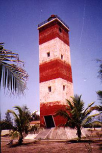
Armagon lighthouse lies in Nellore district of Andhra Pradesh. The lighthouse station is about 80 km from Naidupettai railway station (near Gudur). The last leg of about 5 km of the approach to station is only a cart track involving crossing of Buckingham Canal and bullock cart has to be engaged for the transport. The light house marks the shoal about 6 NM off the shore. Mr Stevenson after...
 
Arnala Lighthouse
th_arnala.jpg
Arnala Lighthouse is about 10 km West by road from Virar Railway station (Mumbai-Surat Trunk Route). Regular Ntransport is available from Virar for proceeding to Arnala. There is a pucca road up to the lighthouse. The coast is about 300 m away from the lighthouse. There is a small island off the coast near the entrance to the creek on northern side. A fort was built on this island...
 
Bedi Bandar Lighthouse
th_bedibunder.jpg
The port of Bedi was developed by the rulers of Nawanagar State (Jamnagar) as a tidal port complex towards the end of 19th Century mainly to facilitate trade with Arabia, East African Countries and Malabar in South. The crafts used to anchor off Rozi and navigate into the Bedi channel when sufficient water for their draughts was available during high tides.A light was provided on the bastion of Rozi...
 
Bompoka Island Lighthouse
not_available.jpg
Bompoka island lies about 2.5 km east from southern end of nearby Teressa Island in the Nancowry group of islands.The hills on the island rise upto 193 m. The island has dense forest and some portions have grass growth. There is thick coconut palm growth on shores all round the island. The portion of sea between the Teressa and Bompoka islands provides a good shelter for the ships. The...
 
Bural Reef (Chanka Island) Lighthouse
th_bural_reef1.jpg
Bural lighthouse on the North West point of the vast Bural reef is an important land mark for vessels cruising in the deep water channel leading to SBM Vadinar and Sikka ports. Bural reef is the largest reef close to Saurashtra coast in the gulf of Kachchh. It has on it three high islets,Bhaidar Tapu, Narara Tapu and Chank Tapu. They are separated from Bural by shallow channels. Bural...
 
Cape Cannaught Lighthouse
not_available.jpg
The Lighthouse has been built on the southern tip of Nancowry Island in Nancowry group of Islands The Lighthouse is approachable by the Lighthouse tender M.V. Pradeep. It can also be approached from Champin Village (opposite Kamorta Island) by walk through the thick forest. Nancowry island is inhabited by local Nicobarese in Champin village on the northern tip of island opposite Kamorta island. The two islands are separated by...
 
Chandra Bhaga Lighthouse
th_chandrabagh.jpg
The Lighthouse is about 3.5 km away by road from the famous 13th century Sun temple of Konark on Puri road. The Lighthouse has derived its name from the near by river Chandrabhaga which has dried down and now no more exists. There was no light provided in this region prior to the present lighthouse. The vessels earlier should be taking bearing with reference to the Sun temple. There...
 
Chank Tapu Lighthouse
not_available.jpg
Chank Tapu Lighthouse is situated on the North Eastern point of vast Bural reef. The Bural reef is in continuity of many reefs and shoals in the region close to Salaya Port.It is possible to reach the Lighthouse by a machine boat from Salaya port during the high tides. However during low tides, the boat can go up to the nearest edge of the reef and then the remaining...
 
Chhachhi Lighthouse
th_chachhi1.jpg
In the ancient period nearby Sandhan was a busy port which was later on abandoned due to heavy silting of the water way. There did not however exist any lighted beacon earlier at Chhachhi. In order to provide uniform coverage and important land mark for the vessels entering the Gulf of Kachchh, this lighthouse was planned during 1955-56.( the first five year plan).Chhachhi village is linked by a road...
 
To List or Submit your listings related to Logistics Directory - Click Here
 
Facebook Twitter Instagram LinkedIn
© 2007 - IndianLogisticsInfo.com. All Rights Reserved
hit counter
Home  |  Overview  |  Advertise  |  Link to us  |  About us  |  Contact us  |  Sitemap  |  Privacy Statement