Indian Logistics Info

Lighthouses

India

Indian Logistics Directory
Search
Home » Sea Ports » Lighthouses
 
To List or Submit your listings related to Logistics Directory - Click Here
 

Lighthouses

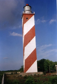
Nagayalanka Lighthouse
th_nagayalanka.jpg
The Lighthouse station is approached from Vijayawada (approx.100km) by road up to Nagayalanka village and then 15 km by motor launch through Krishna river. The station is situated near the mouths of Krishna river. There is a masonry retaining wall, which serves as jetty. A cement concrete path way for 500 m from the Lighthouse station to the jetty has been provided. Krishna river is navigable upto Vijayawada and...
 
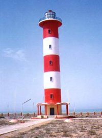
Navadra Lighthouse
th_navadra.jpg
Navadra Lighthouse is about 7 Km South of Dwarka-Porbandar coastal highway. There is a metalled road up to Navadra village and then a dusty cart track exists up to the Lighthouse. The entire coast is rocky and has been converted into wind power generating farm. There are a number of wind generators around the Lighthouse. The wind generators supply electricity to Gujarat Electricity Board grid.There is a small fishing...
 
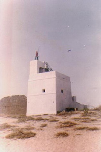
Navibandar Lighthouse
th_navibunder1.jpg
Navibandar is about 35 Km East of Porbandar on Porbandar- Veraval coastal highway. Bhadar an important river of Saurashtra flows into the sea about half a km West of Navibandar Lighthouse. The coastline consists of sand hills and vegetation around the inhabitations. Navibandar is still a fishing port. Navibandar was part of Porbandar princely state and was an important transit centre cum check post prior to independence. It was...
 
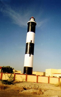
Navinal Point Lighthouse
th_navinal1.jpg
Navinal Point is made up of a few ridges of sand and a large swamp partly covered with the bushes. The mangrove forms the background of Navinal Point. North East ward from Navinal Point, is Bacha Creek on which Mundra new port exists. Vast land on the South-West of the Navinal point Lighthouse was Re-claimed during 1996-97 for Adani port.Navinal point Lighthouse is approachable by a Departmental machine boat...
 
Navlakhi Lighthouse
th_navlakhi1.jpg
Hansthal Creek is the largest of the Creeks originating from the little Rann of Kachchh and flowing into the Gulf of Kachchh. There are a number of mud and sand banks and islets in this region between Kachchh and Saurashtra(in the gulf of Kachchh). One such island formed between Sui Creek and Versamedi Creek is known as Navlakhi bet (Island) which is connected by a high level embankment for...
 
Okha Lighthouse
th_okha.jpg
Okha is well connected by Rail and Road links. There is a daily rail service to Mumbai. It is interesting to note that Okha has the Railway station, Bus station, Passenger Boat Terminal and the port, all situated within one km radius. The famous pilgrim centre Beyt Dwarka is situated on the island opposite Okha port. This region is known as Okhamandal and prior to Independence it was part...
 
Pandiyan Tivu Lighthouse
th_pandiyantivu.jpg
Pandiyan Tivu Lighthouse is the main Lighthouse for the Port of Tutikkodi (Tuticorin) on the Western side of the Gulf of Mannar. There are number of islets/reefs in the region. Tivu is the Tamil version of Sanskrit ‘Dweep’(Island). Pandiyan Tivu an island earlier, was known as Hare Island. It is connected to the main land by an all weather road after reclamation. The Lighthouse is situated on the northern...
 
Pentakota Lighthouse
th_pentakota.jpg
Pentakota Lighthouse is about 13 km from Tuni Railway Station on Visakhapatnam-Rajahmundry section and about 80km by road from Dolphins Nose Lighthouse, Visakhapatnam. There was no lighthouse provided at the site earlier than the present one. A brick masonry pillar was however constructed near to the present Lighthouse site during the early part of the 20th century which served as a day mark beacon. The present Lighthouse was constructed...
 
Pirotan Lighthouse
th_pirotan.jpg

There are 133 coral reefs and islets in the region of eastern side of the gulf of Kachchh stretching from Salaya to Jodiya which formed the part of erstwhile state of Nawanagar prior to independence. Most of the islets are barren. Pirotan is one of them. It is an important land mark for the mariners approaching Bedi Port. Pirotan island is 10 km North West of Rozi island...
 
Point Calimere Lighthouse
th_point_calimere.jpg
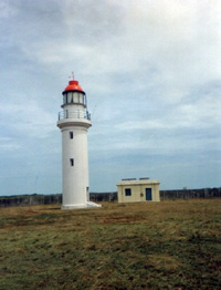
Nearest Railway station is Nagapattinam-about 50 Km from point Calimere. There is a cart track about 5 Km from Kodikkarai village to Point Calimere through forest area for which permission has to be obtained from Forest Department before entering the region and using the cart track.‘Calimere’ is the Dutch word for beautiful. Towards the end of 16th century, the Dutch contingent had camped on this coast and so the...
 
To List or Submit your listings related to Logistics Directory - Click Here
 
Facebook Twitter Instagram LinkedIn
© 2007 - IndianLogisticsInfo.com. All Rights Reserved
hit counter
Home  |  Overview  |  Advertise  |  Link to us  |  About us  |  Contact us  |  Sitemap  |  Privacy Statement